What are weather instruments?
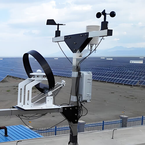
Weather instruments are specialized tools used to observe and measure atmospheric conditions, such as temperature, humidity, wind speed, air pressure, and precipitation. They are generally divided into ground-based and upper-air weather instruments. The data collected is used for weather forecasting, climate research, disaster early warning, agricultural production and urban planning.
Currently used weather instruments can be broadly divided into two categories:
- Ground-based observation instruments: deployed at surface level to measure local atmospheric conditions. Examples include thermometers, barometers, anemometers, rain gauges, and hygrometers.
- High-altitude and remote sensing instruments: detect atmospheric conditions from elevated platforms or from space. Examples include weather balloons carrying radiosondes, weather radar, lidar, and weather satellites.
Modern weather monitoring relies on the coordinated operation of these two types of instruments. This article will introduce you in detail 12 of the most important weather instruments and their uses.
Weather instruments video from Youtube @mikesammartano
Top 12 Common Weather Instruments and Uses
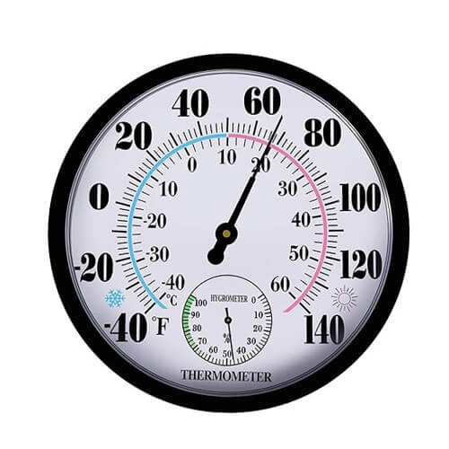
1. Thermometer
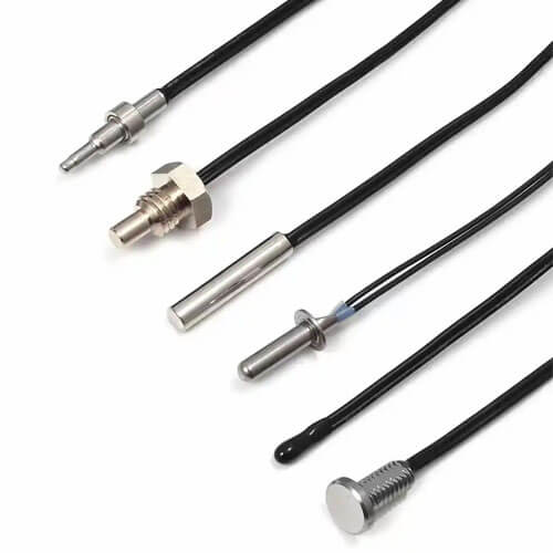
Temperature is one of the most fundamental parameters in weather observation. Thermometers are used to measure and record temperature of a particular region. Because of the development in sensor technology, the modern weather station is now more likely to be equipped with resistance temperature detectors (RTD), thermocouples, and semiconductor temperature sensors rather than the traditional liquid thermometers. Among these, platinum RTDs are widely used for their accuracy and stability, while liquid thermometers are mainly found in traditional weather stations.
Application: By choosing the best thermometer, the more accurate the temperature data obtained, the more accurate the analysis of the weather will be. These data can be used for environmental protection, agrometeorology, climate research and aviation and navigation.
2. Barometer
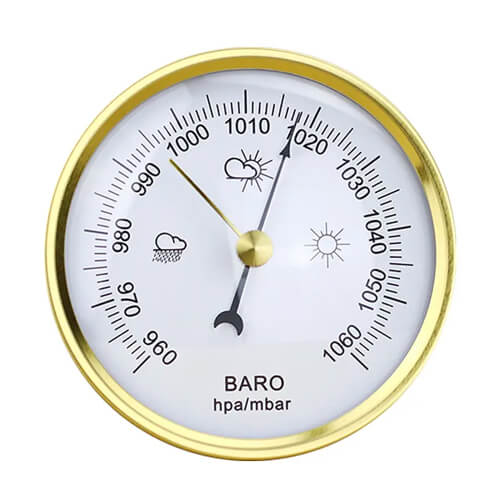
Atmospheric pressure is closely related to wind direction, storms and other weather phenomena. A falling pressure reading typically signals incoming storms or rain; rising pressure points toward clearing skies.
The instrument used for measuring the pressure of the atmosphere is a barometer. Some traditional barometers measure the pressure by using the movement of mercury or the deformation of a sealed metal capsule, such as an aneroid barometer. Digital barometers are the primary instrument used in modern weather stations due to being accurate, stable and able to be integrated into automated data collection systems.
Application: Barometric data is primarily used in weather forecasting, in the outdoors (hiking), aviation and navigation.
3. Hygrometer
Humidity is also an important meteorological condition which is closely allied to temperature. Hygrometers are used to measure the amount of moisture in the air. Older types of hygrometers were based on the change in length of human or animal hair as it became moist or dried out. Today, most electronic hygrometers measure the electrical properties of moisture-sensitive materials.
A large number of weather stations today combine the measurement of temperature and humidity into one temperature humidity sensor, providing compact and accurate monitoring.
Application: In addition to their use in agricultural smart irrigation and weather monitoring, hygrometers are effective in preventing mold growth when used in logistics, transportation, and storage processes.
4. Anemometer
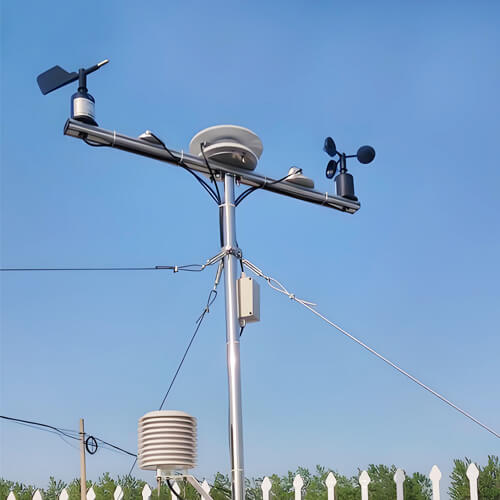
All weather monitoring systems have anemometers, which are indispensable weather instruments. Different types are designed for different applications. Cup anemometers are widely used for outdoor monitoring because of their simple design and durability, while ultrasonic anemometers have no moving parts and can provide reliable measurements in low-wind and icing conditions.
Renke’ s three-cup anemometer is designed for continuous outdoor monitoring, offering reliable wind speed measurement with minimal maintenance.
Application: Anemometers can be used to predict weather changes, ensure flight and navigation safety, assess the spread of air pollution, optimize the design of wind power generation and ensure the safety of outdoor activities.
5. Wind vane
A traditional wind vane usually consists of an indicator (such as an arrow or animal shape) and a vertical axis. The vertical axis rotates due to the wind in the environment and then the arrow points in the direction the wind is blowing. As people demand more and more accuracy, the electronic wind vane was created. It utilizes electronic sensors and rotary encoders to detect the direction and convert it into an electrical signal to provide accurate wind direction data. In the vast majority of cases wind vanes are used in conjunction with anemometers to provide a comprehensive representation of wind properties.
Application: Wind vanes are used for meteorological research, ships and harbors, pesticide spraying in agriculture, air pollutant dispersion direction, building design and wind power generation.
6. Rain gauge
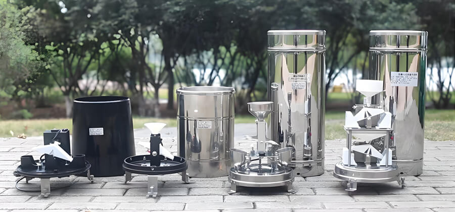
A rain gauge is a device that measures the amount of rainfall in an area and supports viewing rainfall information by date and time period. A simple rain gauge consists of a funnel and a collection container that collects rainwater that needs to be read manually. A tipping bucket rain gauge is a more complex device but is capable of automatically recording rainfall data.
Application: Uses of rain gauges include issuing flood warnings in environmental monitoring, rationalizing irrigation arrangements in agricultural production, and helping to design drainage systems to prevent urban flooding in urban planning.
7. Sunshine recorder
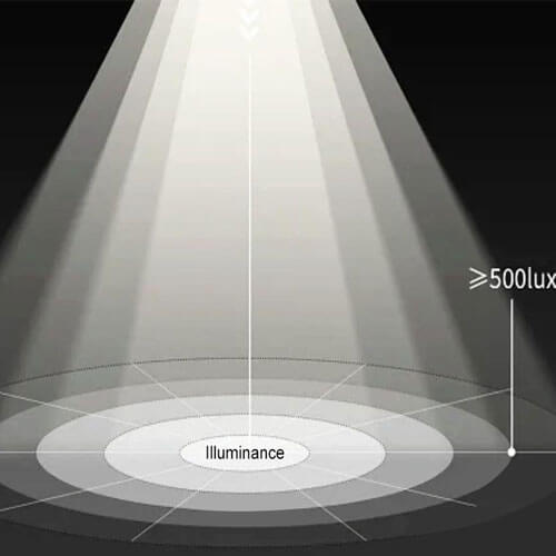
Meteorological monitoring of sunlight mainly focuses on light intensity and sunshine duration. Sunshine recorders are used to measure and record these parameters. Traditional Campbell–Stokes sunshine recorders use a glass sphere to focus sunlight and burn marks on a recording card, while modern digital sensors use photodiodes to convert light intensity into electrical signals for continuous, automated monitoring.
Application: Sunshine data support weather and climate research and are also valuable in agriculture, helping monitor field light conditions and optimize crop planting and harvesting schedules.
8. Radiometer
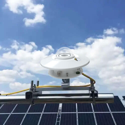
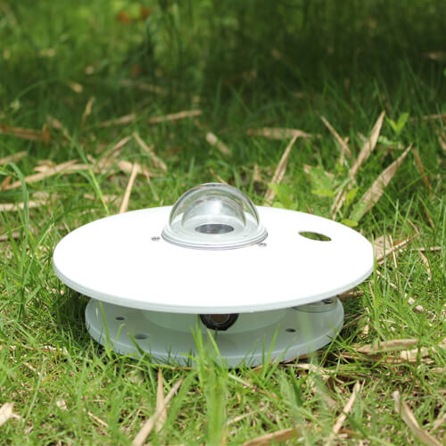
The radiometer is one of the weather instruments that measure the intensity of solar radiation. There are many types of radiometers, and the range of measurement can cover from ultraviolet to infrared. Currently, photoelectric radiometers and thermoelectric radiometers are the most commonly used types in weather monitoring systems. Thermoelectric radiometers are more accurate and correspondingly more expensive.
Application: Pyranometers are widely used to study solar radiation, climate processes, and the Earth’s radiation balance. They also support astronomical observations and environmental research involving radiation.
9. Ceilometer
A ceilometer is used to measure cloud base height, or the altitude at which a cloud layer begins. This measurement is particularly important in aviation, as low cloud ceilings can affect flight operations and visibility.
The modern ceilometer operates on the principle of laser pulses (lidar) and determines the time of their reflection at the cloud base and back. Ceilometers are also used in meteorological stations to track fog formation and to track aerosol layers in environmental research.
Application: Aviation safety, fog prediction, and long-term climate monitoring.
10. Radar
Radar is a radio wave detection technology that is an active microwave atmospheric remote sensing device. Weather radars use a wide range of radio wavelengths, from 1 centimeter to 1,000 centimeters. They are often divided into different bands to indicate the primary function of the radar.
Any radar that does not have Doppler performance is called a non-coherent or conventional weather radar, and a radar with Doppler performance is called a coherent or Doppler radar. Weather radars can detect the height and thickness of clouds that have not formed precipitation, as well as the physical properties within the clouds, so as to analyze the distribution, movement and evolution of precipitation.
Application: Thunderstorm and hurricane tracking, rainfall estimation, and aircraft navigation.
11. Lidar
Lidar is an active remote sensing device that uses a laser as the emitting light source and optoelectronic detection technology. Lidar is an advanced detection method combining laser technology and modern photoelectric detection technology. Lidar’s working principle is very similar to radar, pulsed laser constantly scanning the target object, you can get the target object on all the target point data, with this data for imaging processing, you can get accurate three-dimensional stereo image.
Application: LIDAR is widely used in the fields of terrain mapping, environmental monitoring, autonomous driving, archaeology and urban planning.
12. Weather satellite
Weather satellites are remote sensing platforms used to monitor the Earth’s atmosphere and surface on a large scale. They are equipped with sensors which can measure visible, infrared and microwave radiation and which relay the information they collect back to ground stations for processing.
Application: Cloud cover, precipitation, temperature and wind data are collected from weather satellites for weather forecasting and to track hurricanes, typhoons, thunderstorms and other extreme weather. They also monitor natural phenomena like wildfires, floods, volcanic eruptions and vegetation, soil and environmental changes.
Weather Instruments vs. Weather Stations
Weather instruments measure individual atmospheric variables. A weather station integrates multiple instruments into a single system(combining sensors for temperature, humidity, wind, rainfall, and pressure) so that all parameters are recorded simultaneously from the same location.
This integrated approach is what makes a station useful for forecasting and analysis: a rain gauge alone tells you it rained, but only a complete station tells you it rained while the pressure was dropping and wind shifted from the south. Renke’s automatic weather stations are designed to combine the instruments above into monitoring systems for agriculture, industry, and environmental management.
What are the uses of weather instruments?
Weather forecasting
Real-time data from barometers, hygrometers, and anemometers feeds into forecasting models that predict conditions hours or days in advance. Long-term datasets from the same instruments help identify climate patterns like El Niño cycles or regional drought trends.
Disaster warning
Weather instruments can monitor extreme weather changes in real time, such as flood warnings issued by water level monitoring stations when they detect abnormal water levels, and extreme weather such as typhoons and hurricanes detected by weather satellite systems. Through weather instruments to take timely measures to respond to disasters. Minimize personal and property losses.
Environmental monitoring
The use of anemometers to monitor the flow rate and flow direction of pollutants in the air, such as: sulfur dioxide, PM2.5, ozone and so on. Help the environmental protection department to deal with pollutants rationally and effectively.
Agricultural management
Weather stations installed on farms provide continuous data regarding temperature, rainfall, solar radiation, and soil conditions. This information supports precision irrigation scheduling, frost protection alerts, and optimal harvest timing, which directly enhances crop yields and minimizes resource waste.
Aviation and navigation
Meteorological monitoring is the most important guarantee for the safety of navigation and aviation. Aircraft flights and ships need weather satellite navigation and provide real-time data. It helps them to avoid bad weather.
Urban planning
When planning and designing a city, the data collected by weather instruments make it easy to choose the right place to live. Avoid natural disaster-prone locations. Meanwhile, transportation hubs are scientifically planned.
FAQs
What weather instruments are used in agriculture / aviation / marine navigation?
Agriculture
- Thermometer: Monitors air temperature for agricultural meteorological research and crop growth modeling
- Hygrometer (Dry-and-Wet-Bulb Thermometer): Monitors air humidity to guide irrigation and pest and disease control
- Rain Gauge: Records precipitation for irrigation planning
- Sunlight Meter/Light Intensity Recorder: Monitors light intensity and duration, helping farmers understand field lighting conditions and plan planting and harvest times appropriately. Digital light intensity recorders utilize the principle of photodiodes to convert light intensity into electrical signals, enabling automatic and continuous recording. In agriculture, they can be used to monitor light intensity in fields, helping farmers understand lighting conditions and plan planting and harvest times appropriately.
- Anemometer: Assesses the impact of wind on crops (e.g., pollination, risk of lodging) and the timing of pesticide application
Aviation
- Barometer: A fundamental instrument for flight altitude calibration
- Anemometer/Wind Vane: Used to predict weather changes and ensure flight and navigation safety
- Doppler Radar: Detects precipitation intensity, wind direction, and wind speed; provides hail and rainfall estimates; used for en-route weather warnings
- Weather Balloons (Sounding Instruments): Measure high-altitude atmospheric conditions and provide data for aviation weather forecasting
- Weather Satellites: Provide wide-area cloud imagery and weather system monitoring
Marine Navigation
- Anemometer/Wind Vane: Also used to assess air pollution dispersion, optimize wind turbine design, and ensure safety during outdoor activities; in marine navigation, they are primarily used to monitor wind speed and direction to ensure safe navigation
- Barometer: Used to predict storms and changes in weather systems; it is a fundamental instrument for shipboard meteorological observations
- Radar: Detects precipitation and weather systems, assisting in navigation decisions
- Thermometer, Hygrometer: Used at marine meteorological observation stations; data is fed into comprehensive meteorological networks
I need a weather monitoring station for a vineyard. What insturments do I actually need?
To meet the cultivation and management needs of orchards for cash crops such as grapes, you should install the following meteorological instruments:
- Thermometers and Hygrometers: Monitor temperature changes in real time to provide early warnings of risks such as low-temperature frost and high-temperature heat stress. Monitor humidity to help analyze the meteorological conditions conducive to disease outbreaks.
- Soil Moisture Sensors: Monitor soil moisture and temperature conditions in the root zone to provide direct data for precision irrigation (when to water and how much), thereby avoiding over- or under-irrigation.
- Radiometer: Records the photosynthetically active radiation (PAR) received by grapevines during growth and analyzes the relationship between accumulated light exposure and fruit coloration and sugar conversion.
- Rain gauge: Accurately measures actual rainfall in the orchard to promptly assess drainage and irrigation needs.
- Anemometer & wind vane: Provides early warnings of high winds and serves as a reference for reinforcing structures and selecting the optimal timing for spraying operations.
What is the difference between an ultrasonic anemometer and a cup anemometer?
Cup Anemometer
This device captures wind force using three rotating cups; the rotation speed is directly proportional to wind speed, and wind speed is calculated based on the mechanical rotation. With its simple structure and low cost, it is the most traditional and widely used method for measuring wind speed.
Limitations: It contains mechanical moving parts that are prone to wear; it is not sufficiently sensitive at low wind speeds or in icy conditions; and it requires regular maintenance.
Ultrasonic Anemometer
This device calculates wind speed and direction by measuring the time difference in the propagation of sound waves through the air; it contains no moving mechanical parts. It derives wind speed data by measuring variations in the speed at which sound waves travel in different directions.
Advantages: No mechanical wear; fast response; maintains high accuracy even at low wind speeds and in icy conditions; suitable for long-term, maintenance-free deployment.
I'm building an Arduino weather station. Which wind sensor should I buy?
For Arduino weather stations, the three-cup pulse-output wind speed sensor is the preferred choice. These sensors feature a simple mechanical design and excellent weather resistance. Since they calculate wind speed by counting pulse frequency, they offer far better resistance to interference than analog voltage-type sensors, making them ideal for long-term outdoor monitoring.
My weather station always reports humidity at 99% overnight. Is it broken?
It isn’t necessarily broken; a humidity reading of 99% at night is actually quite common. First, check these possible causes:
Condensation: The most common cause.
As the temperature drops at night, condensation forms on the sensor surface or probe, causing the humidity sensor to hit its upper limit (usually capped at 99% or 100%). If the reading returns to normal when the temperature rises during the day, this is almost certainly the cause, and the sensor isn’t broken.
Sensor Type
If you’re using sensors like the DHT11 or DHT22, they inherently have lower accuracy when humidity approaches saturation. Additionally, at high humidity levels, their response slows down and they tend to get stuck at high readings without dropping back down. Even if the actual humidity drops in the morning, the reading may lag for quite a while before changing.
Installation Location
If the sensor lacks a radiation shield, is too close to the ground or vegetation, or is “trapped” inside a waterproof enclosure(causing the internal microenvironment to become excessively humid), it may also consistently show higher-than-normal readings.
What's the most accurate rain gauge for heavy rainfall?
The preferred choice is a gravimetric rain gauge. It directly measures the weight of precipitation using a high-precision sensor. With no moving mechanical parts, it is not limited by the kinetic energy of raindrops or drainage velocity, and maintains a linear response across the entire range of rainfall intensity. It is particularly suitable for the accurate observation of heavy rain, extreme downpours, and mixed precipitation (such as hail).
If space or budget is limited, a piezoelectric rain gauge or a tipping-bucket rain gauge may be selected.
I need to monitor weather at a construction site with no power. Any recommendations?
To monitor weather conditions at construction sites during power outages, the core solution is to use weather stations powered by solar energy and equipped with wireless transmission capabilities, ensuring that the equipment operates independently without access to the mains power grid and transmits data in real time.
The power supply system must consist of weather stations equipped with high-efficiency solar panels and high-capacity batteries (e.g., 20Ah or more) to ensure they can operate for several days to a week even during cloudy or rainy weather.
For communication, 4G/NB-IoT/LoRa wireless transmission modules are the preferred choice. They eliminate the need to lay network cables and allow data to be uploaded directly to the cloud or a mobile app, addressing the lack of network infrastructure at construction sites.
How does Doppler radar work?
Sends out radio waves that bounce off precipitation; measures frequency shifts to detect wind speed and direction.
What weather instruments do meteorologists use?
Combination of ground instruments, radar, satellites, and weather balloons.
Written by Renke Technical Team, a trusted name in environmental sensing technology. Leveraging over a decade of hands-on experience in manufacturing and on-site installation, our team provides professional guidance on selecting and maintaining weather instruments. We focus on delivering technical clarity and practical troubleshooting tips, ensuring that our clients can deploy monitoring systems with maximum accuracy and efficiency.